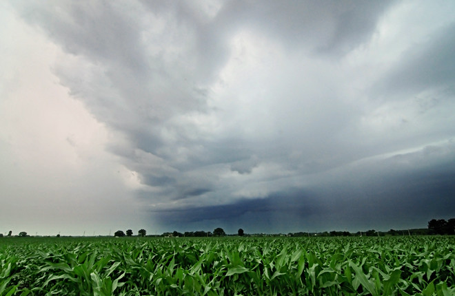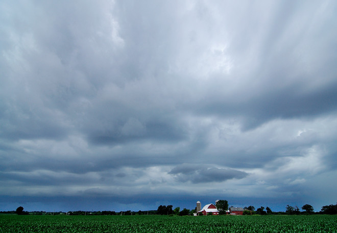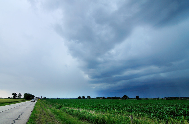
My wife and I followed the progress of a storm system most of the day last Friday. OK, so I followed it. I just kept my wife updated throughout the day. I think she knew that if things got interesting that I might want to go out and meet the storm as it approached our area. The storm eventually cut a path across six states leaving flooding, downed trees and power outages in its wake.
We received a severe thunderstorm watch alert on my cell phone early in the day. From there I logged onto the NOAA weather site, which provides a daily forecast briefing that meteorologists across the country use as reference in preparing their forecasts. The briefing indicated that a large flying wedge of thunderstorms was sweeping its way across Iowa and heading to Illinois and points east. This storm was a surprise -- it had not previously shown up on any of NOAA's computer models.
A combination of strong convection within the system and high velocity winds aloft meant a pretty good show was on its way. The NOAA site hinted at the possibility of the existence of wind shears, which meant that all the ingredients were in place for the formation of supercells.
I hit Accuweather.com for their rolling radar pictures. Using their time stamps and a trusty old road atlas, I calculated the speed of the storm at about 60mph. Whoa. Nothing to do but keep an eye on the weather reports and wait for our uninvited guest to blow in.
Later that afternoon, when the system approached to within 60 miles of my home, I set out to meet it. My wife came along to monitor the radio and keep me out of trouble. The plan was to photograph the approaching storm, then skedaddle our way back home ahead of it. The whole thing was like one of those algebra story problems -- a severe storm with high winds and heavy rains is heading east at 55 mph. A Ford Escape with a crazy man inside is heading west at 50 mph. Where will the two meet?

We met just west of Illinois Route 47, a north-south road in western Kane County. As we got closer to the storm, the visual turned from a shapeless mass of dark gray to layers of churning clouds, including a rather impressive shelf cloud riding underneath the stack. Walls of rain hung from the snarling mass along the horizon like sheets on a clothesline. I turned onto a north-south road, located a red barn to frame against the sky, turned the car around so it pointed toward home, then hopped out into a corn field to get some images.

I've shot enough approaching storms to know when enough is enough. I called to my wife, who sat in the car with her window open (I presume to yell to me to get back in at the appropriate time), and let her know that when the lead clouds hit a certain point on the southern horizon, we would make our exit. That would be our cue to get out fast. The clouds didn't quite make it there before I could hear the slow sizzle of very large raindrops striking the leaves of corn on the opposite side of the field. Time to go. I ran back to the car and just got inside as the rain began to fall on us.
The rain eased, then stopped as we raced eastward, raising my confidence that we could outrun the storm if things worked out for us at a couple of stop lights along the way. At stop light number one, we found ourselves waiting for green behind a farmer on a small tractor hauling a trailer tank full of water. Either he hadn't heard or ignored the weather reports -- there was plenty of water about to be delivered today. Either way, he was about to learn a hard lesson. When the light turned, the tractor pulled out ahead of us at a painfully slow pace. A line of cars the opposite way prevented me from passing the tractor as the rain caught up with us. The tractor hinted at pulling off the road to let us pass, but then swerved back on as the farmer likely rejected the idea of becoming a sitting duck on the side of the road in favor of continuing as a crawling duck. Big raindrops began hitting the roof and windshield as we finally pulled around the slow moving tractor, leaving the farmer behind to deal with his fate.
About three miles from home, any hope of outrunning the system disappeared. A section of storm to the south had raced ahead of the mass behind us and closed in on us in a big wet sloppy hug. We slogged though pouring rain and howling winds the rest of the way, dodging fallen trash bins that littered our subdivision like so many casualties in the streets.
Little damage was sustained in our neck of the woods, although many other areas saw uprooted trees and a few are still waiting for power to return. More storms are in the forecast for the next several days.
I'll keep an eye on them.
Photographs © 2010 James Jordan.


1 comment:
Sounds very exciting. It may be time to build an ark.
Post a Comment