Let me start with a disclaimer. I don't advocate that anyone go out looking for storms without a lot of advance preparation, a plan and a backup plan. In the case of the line of severe storms that rolled through northern Illinois last evening, I had been keeping tabs on reports from NOAA most of the day and keeping Accuweather's rolling radar map within a couple of mouse clicks. NOAA let me know that developing storms would likely follow a path along the top two tiers of counties in Illinois after afternoon surface heating added the final ingredient necessary for the formation of a mesoscale convective system (MCS) -- fancy weather talk for a really big storm. By 4:00, things were developing rapidly along the Iowa/Illinois border. By 5:00 my wife and I had wolfed down a quick dinner and were in the car.
The plan was to drive west while staying north of the storm, then dropping south to catch the back side where hopefully things would be quite picturesque (and safe). While driving, my wife monitored the radio for reports of storm locations as well as warnings from the National Weather Service that we subscribe to on our cell phone.
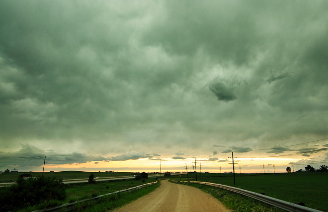
After some zigzagging west and south and skirting the edge of the storm, it became clear that the extreme amount of moisture in this system would obscure most of the cloud formations in the storm cells. Bummer. By this time, we were in Elburn, Illinois and a wall of rain was coming in from the west. We decided to punch through it on state route 38. We were treated to an amazing lightning show along the way. We emerged from the rain just east of Dekalb.
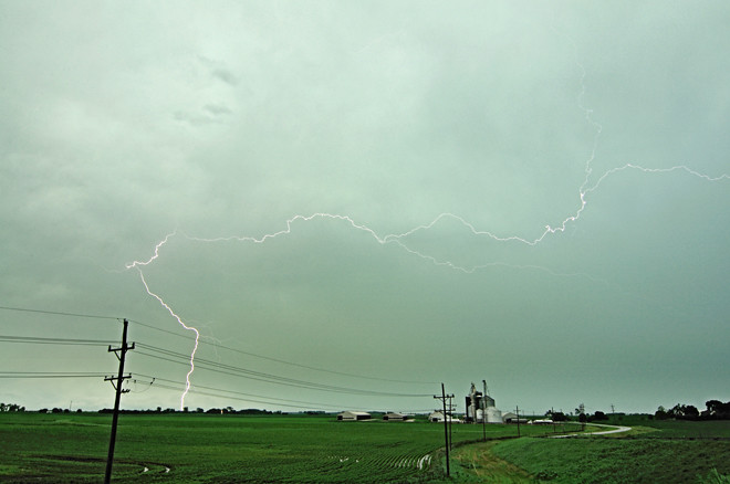
I set up a tripod and set about to capture some lightning. The best way I know to do that is to frame up an area of the sky that is pretty active, set the camera ISO as low as it will go, close the lens aperture all the way down and let the camera pick a (hopefully) long exposure time. I had gotten it down to about a one-second exposure, then just kept clicking away, hoping that lightning would strike while the shutter was open. Out of about a hundred shots, lightning showed up in about a dozen. The image above was the most extensive lightning bolt I was able to capture.
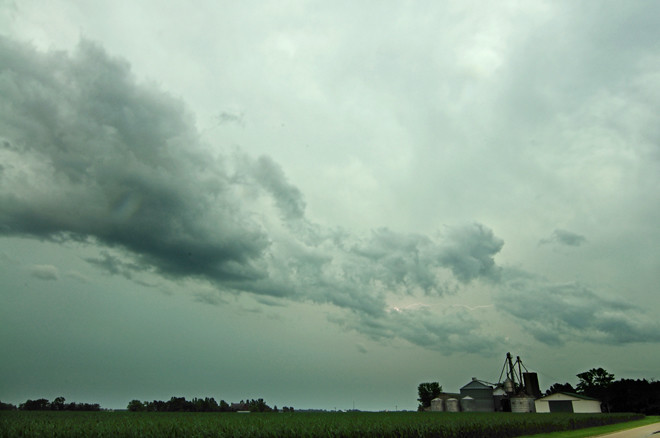
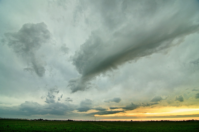
From there, it was a matter of capturing some of the incidental clouds to the system, then sticking around for the aftermath -- in this case, a sky full of mammatus clouds at sunset.

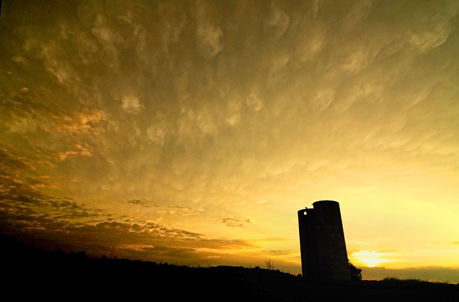
Photographs © 2010 James Jordan.


1 comment:
Thunderstorms are fun. I don't chase them but I do enjoy the crash boom bang of a big storm. Your technique for catching the lightening flash is the best way I know of. Back when we were shooting roll film it would have been expensive to pop off 100 frames or more but digital makes that easy. Nice sky photos, thank you.
Post a Comment