 Door County, Wisconsin is basically a rocky outcropping in Lake Michigan covered with a thin layer of dirt, created courtesy of a large glacier a few thousand years ago. South of Egg Harbor lies Lost Lake, a small inland body of water. Further south lies Clark Lake, once a harbor, but slowly closed in by silt deposited by Lake Michigan's currents. Connecting the two bodies of water is the meandering Logan Creek.
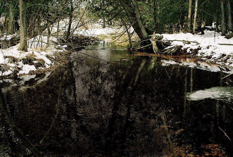
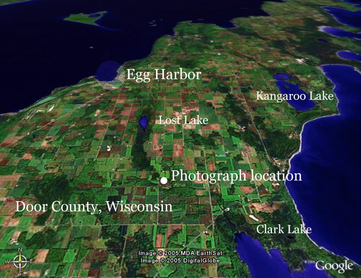
This photograph was taken at a bend in the creek a few yards from where it passes under County Highway T. The small image is a Google Earth map that shows the relationship of the two lakes and the location of the photograph.
As I noted before, the skies were not too cooperative while I was in the county last week, and I had hoped that any scene that blocked the sky may be helpful to my cause of getting some
 interesting photos. I'm sure there is some kind of lesson here about forging on even when the conditions are not ideal, but I'll leave that to you.
This photo required a large amount of dodging and burning to bring out the trees in the background and tone down the reflections in the water.
Click on images to enlarge. Photograph © 2005 James Jordan.


3 comments:
Beautiful photos, my friend! Happy New Year! Keep up the awesome work!
I love this :)
Thanks, all!
Jack, I shoot film, scan the images to CD, then do post-processing in PhotoShop. Usually nothing more than play with the levels a bit. Some photos, like this one, require more work to get them to where I'm happy with them.
It's kind of a long story as to why I haven't made the jump to digital ... if you'd care to know more, let me know.
Post a Comment